Sunday, December 28, 2008
Last Walk of 2008

Great day for walking with fine views in all directions.
The Mourne wall was a clean and dry way to cross the Bog of Donard - if you didn't mind the height.


Margaret striding out towards Donard
Sunset with Carlingford and Slieve Foy in the distance

Paddy and Tony crossing with the - eh, additional supplies!

View towards Newcastle
Tuesday, December 23, 2008
Memories of 2008
Sunday, December 21, 2008
Forkhill and the poets trail
Tuesday, December 16, 2008
Comedagh
A good walk in misty condition following the Mourne Wall from Hares gap Approximately 14 Km.

From about 500 meters up the ground was frozen and nearing Comedagh we topped out over the cloud in the valley.
As conditions were right I had a look over the Mourne wall into the Pot of Legawherry which was filled with mist and right enough an optical phenomen know as a Brocken Spectre was visible, but faint. I managed to get a photo of it (click on photo below for a better view). The following is an extract from Wikimedia
A Brocken Spectre, also called Brocken bow or mountain spectre is the apparently enormously magnified shadow of an observer, cast upon the upper surfaces of clouds opposite the sun. The phenomenon can appear on a misty mountainside or cloud bank, or even from an aeroplane, but the frequent fogs and low-altitude accessibility of the Brocken, a peak in the Hartz mountains in Germany, have created a local legend from which the phenomenon draws its name. The "spectre" appears when the sun shines from behind a climber who is looking down from a ridge or peak into mist. The light projects the climber's shadow forward through the mist, often in an odd triangular shape due to perspective. The apparent magnification of size of the shadow is an optical illusion that occurs when the observer judges his shadow on relatively nearby clouds to be at the same distance as faraway land objects seen through gaps in the clouds, or when there are no reference points at all by which to judge its size. The shadow also falls on water droplets of varying distances from the eye, confusing depth perception. The ghost can appear to move (sometimes quite suddenly) because of the movement of the cloud layer.The head of the figure is often surrounded by the glowing halo - like rings of a glory, rings of coloured light that appear directly opposite the sun when sunlight is reflected by a cloud of uniformly-sized water droplets.
At the top of Comedagh we managed to squeeze into the summit shelter to get our lunch before heading down to the Mourne Col and back by the Brandy Pad

Wednesday, October 15, 2008
CROWS in Wales


(lets hear it for the girls!)

(Summit of Snowden 1085m)


Saturday, September 13, 2008
Vallee Blanche


The length of the route was about 20 km and the main difficulties were in finding a safe route through the crevasses. After the crevasses we had a half dozen ice pitches to climb down and some abseiling off cliffs above the hut.
Summit Day Grand Paradiso

The summit of Grand Paradiso - this was what we were in Italy for!
When we got up at 3.30 am it was bucketing rain and there was thick mist. Departure was put on hold.
 Up to this point there were only 2 other parties on the mountain but groups now appeared from several different directions and we were soon jostling for position on the very narrow summit block
La Tresanta
 At 3600m high this would get us ready for the climb to Grand Paradiso. A straight forward glacier traverse was followed by a climb over a snow bridge at the bergschrund at the top of the glacier and a rock climb onto the ridge itself. That was followed by a long and tiring climb to the summit in mist. Some photos and a little bit to eat and we headed back down. No views due to the poor weather but we were sure we would benefit from the altitude.
 The descent was tricky and required good judgement.
The return to the hut in mist and rain made us wonder if we would have the weather window the next morning. The decision was to get up at 3.30am anyway and be ready for the start. We got ourselves ready (removing any equipment judged too heavy and were in bed at 9.00 pm.
Setting out for the Refuge Victorio Emanuelle II

After a late arrival in Pont (Val Savaranche) we had a relaxed start to the Refuge. The sun shine kept everyone's spirits high.
A two hour hike to the hut was followed by a few hours on the glacier working on our skills and checking out a route for the La Tresenta climb the next morning.
We arrived back at the hut in the rain and had a good meal before settling down for the night. We were up at 5.30 am for the climb
Thursday, September 4, 2008
Wednesday, September 3, 2008
Training for the Alps
Thursday, August 7, 2008
Walk 27 July Slieve Martin and Kilbroney
Monday, August 4, 2008
Canoeing on the Lower Erne

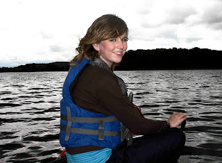
Setting off from Enniskillen on a bank holiday Monday. Weather good and winds light. We visited the island of Devenish with its Monastic settlement and then headed west on the lower lake. Stopping off at a small jetty for a picnic. Good fun and loads to see. Some of the cloud formations were fantastic.
Sunday, August 3, 2008
Friday, July 18, 2008
Saturday, April 19, 2008
And Finally
 After a good night we left Zermatt and spent a day travelling by train back to Chamonix. It was good to get the weather to finish the route but it would still have been a great mountain experience regardless. We met some great people and spent time amongst the most amazing scenery in Europe and that alone made the trip worth while.
 Wednesday, April 16, 2008
Zermatt at last!
 We are in zermatt we made it! Today, we crossed seven high glaciers, three mountan cols and two Countries in approximate thirty KM journey. We are in a small guest house and are well rested and fed. We're heading back to Chamonix tomorrow by train.
We started out at about 6.30 am from the Vignettes Hut under a blue cloudless sky (the forecast had got it wrong but in a good way for a change). At some stage during the night the high winds died down. Unfortunately, a couple of lads didn't make it to the hut and in the clear morning light they could be seen about 500 m away and 300 m up the glacier. The Air Glacier rescue helicopter was making brave efforts to get to them but the avalanche risk was high and the unlucky pair were in a terrible place. Hopefully they got down and without any cold injuries.
The move to the first col (Col L'Eveque) was difficult. With the temperatures down at -20C the skins wouldn't stick on Gerry's skies. They kept falling off giving him huge difficulty. I tried using gaffer tape but it just broke into pieces. Gerry eventually managed with some tape that was stored in the rucksack and two velcro straps. First prize for being cool under pressure. We eventually got to the coll and into the sun light and everything started working again! A great ski down into the Glacier D'Arolla valley and an amazing skin up the next valley with the Bouquitin Hut visible on the far side high up on the ridge. The Col de Tsa de Tsan looked inviting but the route went straight up the steep slope straight ahead.

The second col (Col Mount Brule at 3400 m) was indeed steep and difficult and we had to carry the skies on our ruck sacks. With the weight now almost 18Kg the altitude certainly kicked in! Again, the views were fantastic.
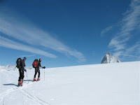
The third col (Col de Vapelline at 3800 m) required a long traverse across the glacier. Groups broke up into 2s and 3s and the heat took its toll. After 2 hours the tip of the Matterhorn came into view a great moment; leaving us just 14 Km to go. We passed the Finns and other groups on the climbs but their excellent skiing meant that they left us behind once the down hill sections came.
Some back slapping and a few nice pints of beer at the first cabane we came to and then a ski down to the town of Zermatt at 6pm in the evening.

The main objective now was to get somewhere to stay for the night.
Zermatt sits at the bottom of the Matterhorn and cars are not allowed. We nearly got run over by the little electric vans that act as taxis until we got used to them.
The Alpen Rose Hotel was the first hotel we called to and we were glad to find it was reasonably priced and had a restaurant.


